CP 1 - Canoe-O down by creek
CP 2 - Top of ridge in woods (Passed Hoverman)
CP 3 - Transition to Paddle (Hoverman passes) Picked up Tire, 4 hrs paddling
CP 4 - Transition to River Boarding
CP 5 - Left side of River on Log
CP 6 - Transition to Trek
CP 7 - Sticker under bench overlooking JRSP
CP 8 - small creek west of small lake
CP 9 - Re-entrant South of big bushwhack
CP 10 - Re-entrant North of big ridge
CP 11 - Gary Fisher Time Trial Start
CP 12 - Gary Fisher Time Trial Finish
CP 13 - Red gate past sneaky drive way road
CP 14 - Church Built on...
CP 15 - Transition to O-Course 1 (In at 12:45am)
CP 16 - Transition to Bike-O course (Out at 4:00 am) (Team morale down for first two points)
CP 17 - Transition to O-Course 2
CP 18 - Transition to Bike
CP 19 - Gas station (gas price)
CP 20 - Elk Hill Farm (Dropped)
A work in progress...
The night before the start, Friday, we checked in and dropped off our canoe and bikes with the race officials. We were hoping to get our maps and at least some coordinates then but we'd have to wait until the next day. By then, we were all pretty hungry and snuck in some Sushi at a local restaurant before the official race meeting at 8:30PM. After an introduction to the staff and sponsors and a Q&A session, we received directions to the race start (we thought) and went home for some final preparations. That night we weighed ourselves so we could see what we needed to replace when we finished and weighed our packs. My pack with food, water and all mandatory team gear came in at just over 29lbs. Saturday, we showed up to the start little early hoping to get a little extra time with the maps for plotting and route planning. Promptly at 7:30am, we were given a large manila envelope stuffed full of 8 maps of varying scales and were instructed that we had to be on one of the school buses at the end of the field in 5 minutes with all the rest of our gear. Typically, at these things, you get one or two maps and have ~30mins to plot coordinates on picnic tables and start right from somewhere near your vehicle. Not this time... We were crammed elbow to elbow on a school bus with 40 other racers with all the gear stacked to the ceiling in the back of the bus for 2 hours driving down dusty windy back roads of the Virginia Piedmont. It was chaotic with teams trying to pull out each of these huge maps that folded out to cover a whole seat, figure out how it connected up with the other maps and then plot the 22 race coordinates. Typically, Jason Smith A.K.A. "Smitty" calls out the UTM coordinates while I plot them and then we double check them when we've plotted all coordinates on a given map. He gets motion sickness so he was quickly out of the game and could just look out the window and try not to hurl. Jason Heron, "Heron" didn't have any experience with UTM plotting or navigation but after a quick tutorial, he had the hang of it and was reading off coordinates and helping me check them. The bus was loud, dusty and all the other teams were calling out their coordinates. We were cramped for space and I'd never worked with more than a few maps in much less intense situations. I was thinking how insane it all was and about how could we have ever prepared for something like this? It was then that I realized HAH!, We couldn't have prepared for this situation and this is exactly what we were paying these guys for... to chuck us outside our comfort zone, make us think on our feet, learn under fire and grow or perish. This was awesome. About 3/4 of the way through plotting, the intense focus and swaying bus started to get me sick. I would have stopped plotting but thought about John P. on that Halibut boat sneaking off to the head several times but never letting anyone know how awful he felt. After a quick break, I pushed through the rest of the coordinates, packed up the maps in the order we'd use them and put my head down on the seat for the rest of the ride.
When the bus stopped, we were close to 70 miles away from where we started. We unloaded to find our canoes lying out in a field. The first leg of the race was a Canoe-Orienteering course. There was a wrist band attached to the front handle of our canoe that had to be punched with a special pattern at each of the controls. We loaded our packs, paddling and river boarding gear in the boat, strapped on the portage wheels we'd later be so thankful we brought, picked up the SPOT Messenger unit. I used the head and spent the last few minutes before the mass start fixing Map1 in my map case and figuring out which way we'd head out of the field to go nab the first point. (Some teams had up to a 30 minute head start based on the results of an optional river boarding prologue the day before. Due to the clusterfudge that was getting everyone together with all gear, we hadn't had time to run that mini-course.)
We edged our way to the front of the group and surrounded by about 15 other teams, they released us into the wild with a dramatic countdown. The Canoe-O consisted of 3 controls and took us from this field through the woods and trails about 3 miles to the James River. Our wheels were working well and we passed several teams who were straight carrying their boat or whose "roll your own" wheels had already broken or fallen off. In our excitement, we blew by a re-entrant where the first control was hidden by about 100 yds. Quickly realizing the error, we went back and waded through the crowd and some swampy muck and punched the point. Next was a choice between a long way around a mountain or straight up and over a steep trail. We chose the trail and passed two more teams on the way up. Smitty and Heron pushed from the back while I pulled from the front. Near the highpoint, we ran into an intersection of trails and 2 other teams looking around in the woods for the control. I had it plotted on over the other side so we slid past those teams, found the point and discretely left the area. The last point was down on the water at a manned transition area. They confirmed the codes on our boat band and once we had on our paddling gear they signed off on us to leave.
At this point it was nearing noon and the mercury had risen to 90 degrees with high humidity. The river is wide so we'd spend the next 4 hours out cooking in the open sun. When we started out, Smitty took the bow position to provide the most forward power, Heron took the stern to guide and I took the middle to paddle and navigate when necessary. The 16' Blue Hole canoe was only setup with 2 seats so I stacked our boogie boards and sat Indian style in the middle of the boat. After a few minutes of winding around all over the place it became apparent that while Heron is a good kayaker, he didn't have much experience on a single bladed paddle in a canoe. He and I switched places and we continued on down the river. The nav on this leg was easy. We just had to go 16 miles down the river and collect some trash along the way. Racers were awarded a 2 minute time bonus for every aluminum can or glass bottle and the maximum of 1hr bonus for collecting a tire. About 30 minutes into the paddle, we found our tire which ended up giving Heron a much better seat in the middle of the boat. The river was very low and with our heavily laden boat, we spent a lot of time dragging, pushing and scooting through the many shallow gravel bars. At one point, we got snagged on a rock, spun sideways and were dangerously close to getting side pinned and flipped. Everyone reacted fairly quickly to my "High Side... LEAN DOWNSTREAM!!!" commands and we spun off the rock. Another noteworthy event was when given a choice between two particular branches of the river, we chose the straighter, shorter route on the other side of which we could see teams paddling in the distance. We had worked hard to pass two teams on the paddle. They chose the longer route and gained probably 1/2 mile on us when it was all said and done. After that, the phrase "River water rarely bothers to take a shortcut and neither should we" kept ringing through my head.
True to most AR canoe sections, the way you know you're getting close to the transition area is that when you are just over it and have absolutely had your fill of canoeing, you have about 4km left to go. In the future it would probably help to paddle 3hrs and THEN look around for a tire to load in the boat. We were having to work extremely hard to hold ground with teams that had double bladed paddles. I'll concede that this could be largely due to our lack of paddling practice as a team and as individuals.
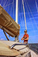
We pulled into TA2, unloaded our tire and unpacked the rest of our gear. We found our bikes staged there but we would go out on Riverboarding and Trekking legs before hopping in the saddle. The race officials instructed that we would only need a minimum of gear over the next two legs, basically maps and our food/hydration. At this point I was having a tough time deciding what to bring and what to leave with my race pack at the bikes due to a pretty sizable hydration deficit I ran into during the canoe. At one point Herron looked at me and asked if I was OK because I was looking all "Doe Eyed". After getting the maps together for the next two sections, we finally grabbed our fins, life jackets and Herron put all our shoes and socks in a dry bag in his pack and stashed some water treatment tablets and E-Tabs. Smitty and I packed our pockets with food and hung water bottles off our life jackets. We jogged down to the river and eased in the water with our kick boards. The water temperature was awesome given the 90+ degree heat and high humidity. Unfortunately we faced the same basic problem of low water levels although this time our bare knees were exposed to the reef sharp rocks. Control 5 was right on the water and readily visible making the couple km kick fairly uneventful. This leg was pretty frustrating as we basically crawled down the river in the prone position intermittently gashing up the fronts of our legs. The real bummer was that we had expected the water segments to be the most fun and they win the first place prize for most suck. Rounding a bend in the river to the last 1Km straight shot to the next TA, we decided we'd had enough, exited the river, scrambled up the bank to a parallel trail and transitioned to our dry trekking gear. We had some discussion about whether we'd be penalized for not spending the entire leg in the water but figured as long as we nabbed CP5, we could argue that we had in fact been in the water. At this point our feet were wrinkly old man feet so we took a moment to dry and powder/lube them up. It was amazing how much faster we could move on land than in the water and jogged into the TA in just a few minutes. We pulled into the CP in 16th place out of the 35 teams still in the race.
Smitty took our River boarding gear to the UHaul while I changed maps and plotted our course to the next Control. At this point we were feeling pretty sweet about a good decision hitting the trail instead of staying in the river and finally getting a quick transition. We took off down the road and took a short whack over a small saddle cutting off about 1Km of trekking. It felt good getting into open hardwood forest to escape the heat. At CP7, we had to write down a number found on a sticker underneath a bench overlooking a beautiful section of the James River State Park. The exit from there gave us a few options. One of them was a newer trail not on my 1:24k map so we opted to go back out to the FR where we attacked the point from. We noticed two other teams take the other trail. Jogging along, we made it back to the gravel road and hung a left. Both of the other teams emerged right in front of us a short ways down the road. We kept cooking along and passed them back, taking a right on the next designated trail. We noticed quite a few newer signed trails that weren't on my map. My plan had been to reach a certain re-entrant and bushwhack. We found one of these new trails that headed basically in the right direction and we decided to take it until it no longer made sense. It was now that Smitty overheard another team looking around for "Chestnut Trail". Suddenly it dawned on us that if they knew the names of these new trails then we must have missed that one of the supplemental maps and this trail system on it. My heart sank as I knew I only brought the maps I thought we'd need to save weight and left the rest back at my bike/pack several miles away. Overall, we did pretty well using the trails when they did what we needed and bushwhacking the rest of the time. We found CP8 pretty quickly in a creek bed southeast of a small pond. At this point we were getting low on water so Smitty did the honors of filling water bottles and treating them while Herron and I plotted our route to the next point. If we had the supplemental map we would have just jumped back on the same trail and rolled around a small mountain to the next CP. Not knowing for sure where those Wiley trails went, we chose to ride a bearing straight over top of the hill. Smitty (a.k.a. kaizen's favorite trail blazer) lead the charge up and over keeping on course from instructions from the back. We found CP9 without much searching. This time we heard another team searching around higher up in the drainage and so we exited quietly to the South. At this point we were at a pretty big disadvantage not having the supplemental trail guide but we chose one again that seemed to behaving itself directionally and while doing some winding around, it did get the job done spitting us out on a gravel road.
Crossing the road, the trail continued on out onto a long spur. We plotted the point down in a strong drainage to the south of the ridge about 1Km away. We jogged out the ridge to the West for about 5 minutes and then dropped down off into the drainage to the left. After following the drainage down much further than we thought the control to be, the left hand ridge stopped agreeing with the map by dropping elevation pretty close to where we were. After a long discussion, we accepted that we weren't where we thought and started relocating. Smitty noticed a gravel road to our South which meant we were one Drainage too far in that direction. Having come so far down, we had little choice but to head back up on the ridge and roll down the other drainage from its head. Herron was starting to feel bad and needed to get some calories in the tank. I stopped with him briefly while Smitty charged off down to locate the CP. We were a bit uncertain after the last nav error but once we were back on track we found the control pretty easily. The end of our present re-entrant spit us out back close to our bikes in the riverside field.
Finally having all the maps again and knowing we'd be shortly riding into the night, I laid out all the remaining maps and noted how they related to one another. I drew rectangles on the large scale maps where the remaining supplemental maps matched up. I also chose and highlighted routes to the CPs we knew about. While this took time, it was much easier to accomplish all at once in the daylight when I was feeling pretty good than later in the race. While I was doing this, Smitty was busy filling up water bladders and bottles. With the nav work wrapped up for a while I finished up the transition and jumped on my bike the guys had all ready for me.
The bike up to CP11 was a nice climb up into the Virginia foothills. Eventually we got up high enough to see some good long range views out to what I'm assuming are the Shenandoah Mt. Range. The sun set quite spectacularly across the landscape and shortly thereafter an almost full moon rose right in our path. We arrived at the Gary Fisher Time Trial and chatted with the volunteers for a bit to learn we were in around 18th place. The volunteers were extremely friendly and let us know we wouldn't need our packs or any mandatory gear other than our bikes, lights and helmets for the time trial. The trial consisted of a sustained and steep 4km ride up a mountain to a "spectacular view". We ditched all our stuff and agreeing that we'd weren't at risk of being close to winning the thing decided to just keep a sustainable pace up to the top. After about 15 minutes of riding and passing several teams on their way back down we came to a fork in the FSR. The nice new gravel path on the road we had been on continued up the left fork and the right fork was obviously a much older road. Once again I kicked myself for not having brought a map. I had examined the time trial route and saw that it was an out-n-back up a single Forest Service road and the CP was plotted right smack in the middle of the road. I had left all maps and my compass back attached to my pack. In hind sight, having it wouldn't have really helped us as the new road wasn't on it but it sure would have helped my team not be miffed at me for not being able to confirm this on the actual map. Smitty brought up he thought he saw someone heading up the right fork. I hadn't seen that so I led us up the left fork. Feeling guilty from leaving the map, I charged ahead. 200vft and 1/4Km later I reached the top and quickly saw that we wanted the other fork. Both Jason's were going through a physical low and so the rest of the trial was just a head down grind up to a Cell Tower and the CP. We all punched the team ID cards on our bikes to prove we'd been there and headed back down. It became apparent that the biggest determination for who won that trial and a free trip to Switzerland was not how fast you could climb but more about who would throw caution to the wind and fly down the sketchy steep gravel road. We magically finished in 16th place without having passed or been passed as two teams ahead of us dropped from the race when they finished the Trial. We quickly packed up, refolded the current map and left the TA around 8:30PM.
After riding on gravel and paved roads for around an hour, we came to a 'T' in the road. My map clearly showed a quick Left-Right onto another forest road. Directly across the street was what looked like some one's house with a small 30m long driveway in which cars were parked. We rode left on the paved road for 1/3 km and stopped when we didn't find any other roads heading off from the right. One or two other teams seemed to be circling this stretch of road looking for the same FSR. Upon inspecting the maps more closely, a small black square was shown in the corner of the two road intersection. This must be that house back there! It felt weird riding up their little driveway. Sure enough, at the back of the driveway was an open gate that led to a small old logging road. We quickly turned off our tail lights so as not give away our position and headed out to CP 13. The bike computer once again proved to an awesome piece of gear. We rode out into the virtually unpopulated Virginia Piedmont for the estimated distance and took a right to a red gate to find CP 13. Here we passed two teams that looked like professional bikers (Ohhh Yeah!). Eventually the gravel dumped us back onto paved roads.
I typically find my nav sweet spot a few hours after sunset and I was getting dialed in. We got into a hella sweet pace line and blazed through twisting back roads and many turns. I would call out the distance to and name of the next road to turn on and the direction of the turn. When we started, Smitty was the least experienced at this technique but by the time the night was through, he was riding wheel quite capably and a believer in how effective it is. I think we passed 2 or 3 teams while we were going full tilt and they were stopped to figure out if a particular road was the turn they wanted. This felt goooooood. After about an hour we made it to the church and CP14. Our task was to record the date the church was built from a plaque to the right of the door. It was good to see 4-5 other teams there regrouping and resting. I don't know what it is about churches and not having water spiggets on the outside but we were quite dissapointed not to find water there as we were running low. With no luck in the water department we cruised out of there and hopped back on the pace line. In the back of our minds was the 1AM Pro course cut-off at CP15 but also in there was the fact that we would shortly be out of water.
Our race pamphlet listed a Win Dixie Grocery store in a small town along our route. We cranked on getting there to find two teams sitting around the locked doors on the sidewalk. The store had closed about 15 minutes before we got there. No problem, we could see the Golden Arches shining in the distance. Passing two closed gas stations on the way, we lucked out to find McD's open for business. It was obviously a total mind trip for the locals to see these crazy white guys and girls come riding out of the night all muddy and beat up with tales of having over 50 miles left without a motorized vehicle. One particularly amusing (and blitzed) character was talking to Herron and commented on his awesome chest tattoo. He reached forward as if to pull open Herron's bike shirt to see more and then realized it was just a massive chest hair farm. That moment was priceless as he almost jumped out of his skin in surprise. On the inside, I purchased a large coke and large water and replenished all my water containers from the fountain, saving my bike water bottle for Coke mixed with Accelerade (the kick in the butt I'd need later in the ride). I prepared the the maps to get us the rest of the way to the first O-Course while Herron and Smitty got some warm food to eat and replenished their supplies.
In order to make it to the O-Course before the Pro course time cutoff at 1AM, we'd need to ride faster than an average of 16km/hr. In our pace line we ranged from 14km/hr to 35km/hr depending on how many hills we were hitting. It looked pretty good for us to make it with some time to spare. This next stretch was fast and sweet. I got out front and broke the wind for a while and we sailed into the TA at 12:45AM with 15 minutes to spare.
Subscribe to:
Post Comments (Atom)
No comments:
Post a Comment